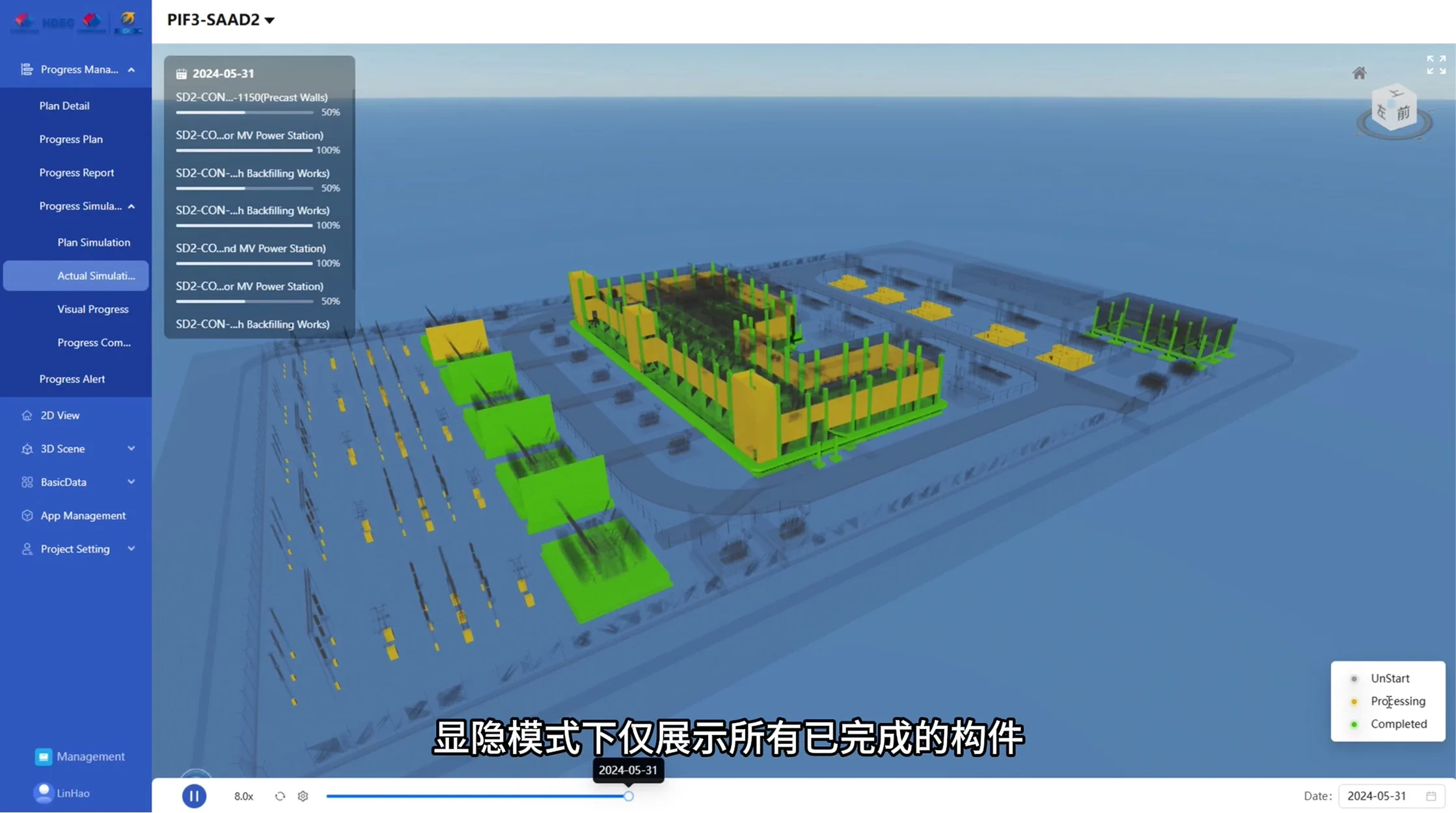
Present progress spatially
The project uses BIM, GIS and 4D simulation to create a digital planning environment for detailed progress control.
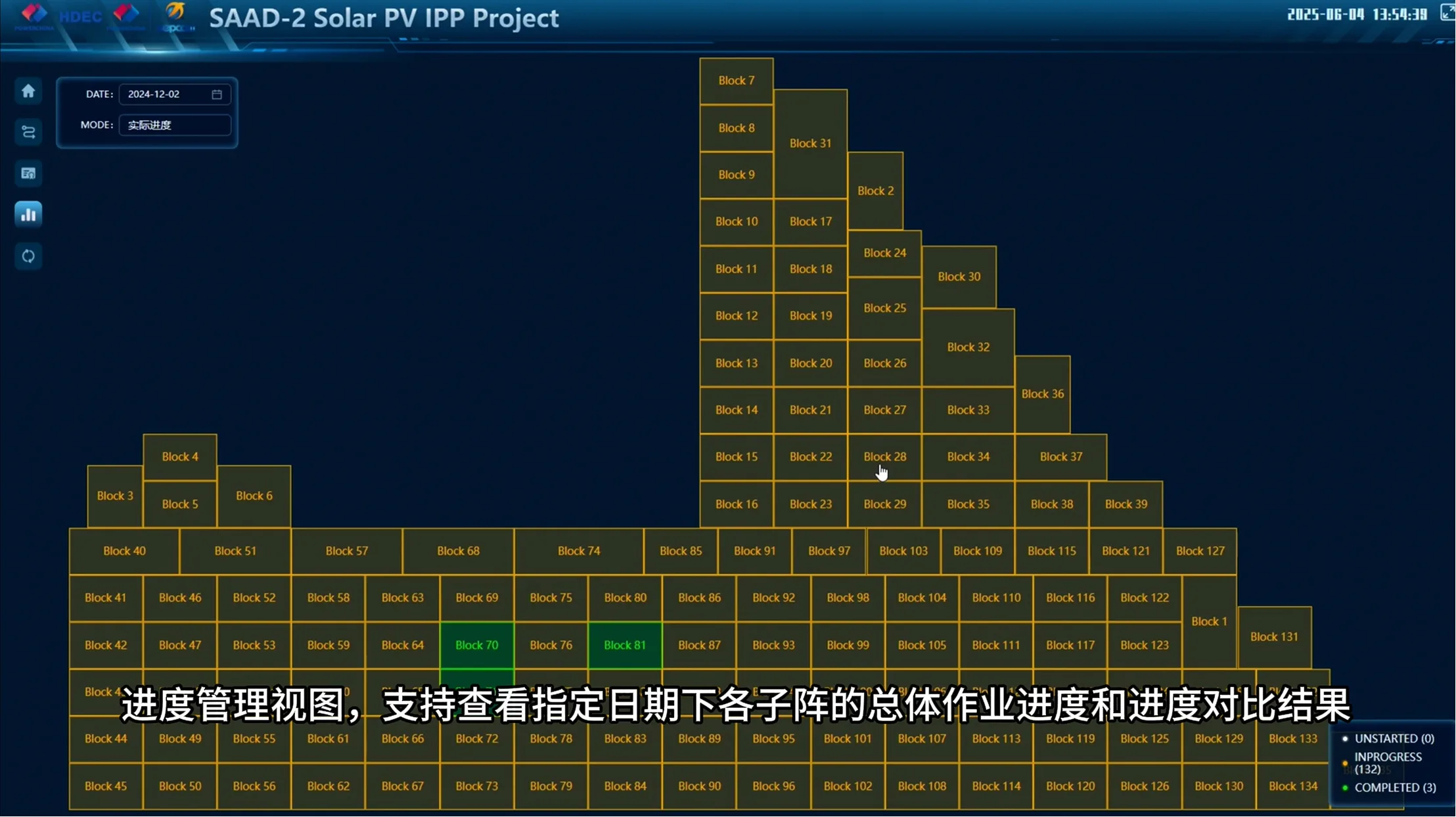
The project uses BIM, GIS and 4D simulation to create a digital planning environment for detailed progress control. Models are linked to planned and actual schedules, while status colors, timeline playback and spatial positioning show work across the substation, solar field and critical activities for tracking, delay alerts and construction-option review.
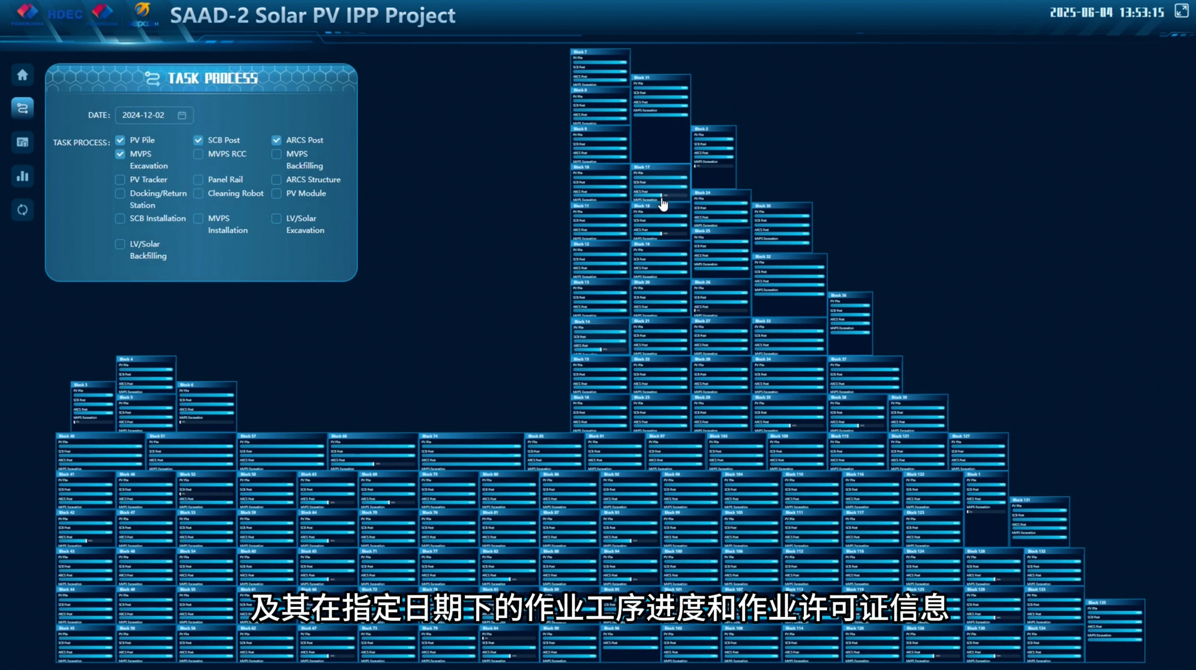
The project uses BIM, GIS and 4D simulation to create a digital planning environment for detailed progress control.
Models are linked to planned and actual schedules, while status colors, timeline playback and spatial positioning show work across the substation, solar field and critical activities for tracking, delay alerts and construction-option review.